I’m making my way west to Portland where I’ll drop off the Airstream for some exciting reno work inside. I’m wending my way there by taking some scenic routes when I can. Interstates are draining – they are often soulless and busy. Dodging trucks is no fun. I don’t have a hard and fast itinerary but have a Google map filled with “want to go” pins dropped. Some are campgrounds, some are points of interest. The fun of taking a US Highway or local road is you never know what you will find. On this segment of my trip, I hit three national parks – Grand Canyon, Petrified Forest, Bryce Canyon, and several national forests, monuments, and Glen Canyon Recreation Areas. Jackpot!! At the end of this post is a very cool Recreation.gov contest about sharing your story of visiting national spots – check it out! I also came across other special places and stood on a corner!
I started this leg of the trip in Socorro, NM. I headed out on a US highway to skirt the southern mountains and make my way to AZ. The weather was great and I drove along the two-lane road, going up. I started at 4600 feet and topped out at 7700 feet when I crossed the Continental Divide – formally entering the west. High plains fascinate me. I never knew they existed until I took my first road trip to SD. I was amazed that flat land existed at high elevations. I’m from the midwest where flat land sits at near sea level. At least that’s what my rational mind processed. I came around a few curves and through some forested land that opened up to the Plains of San Agustin.
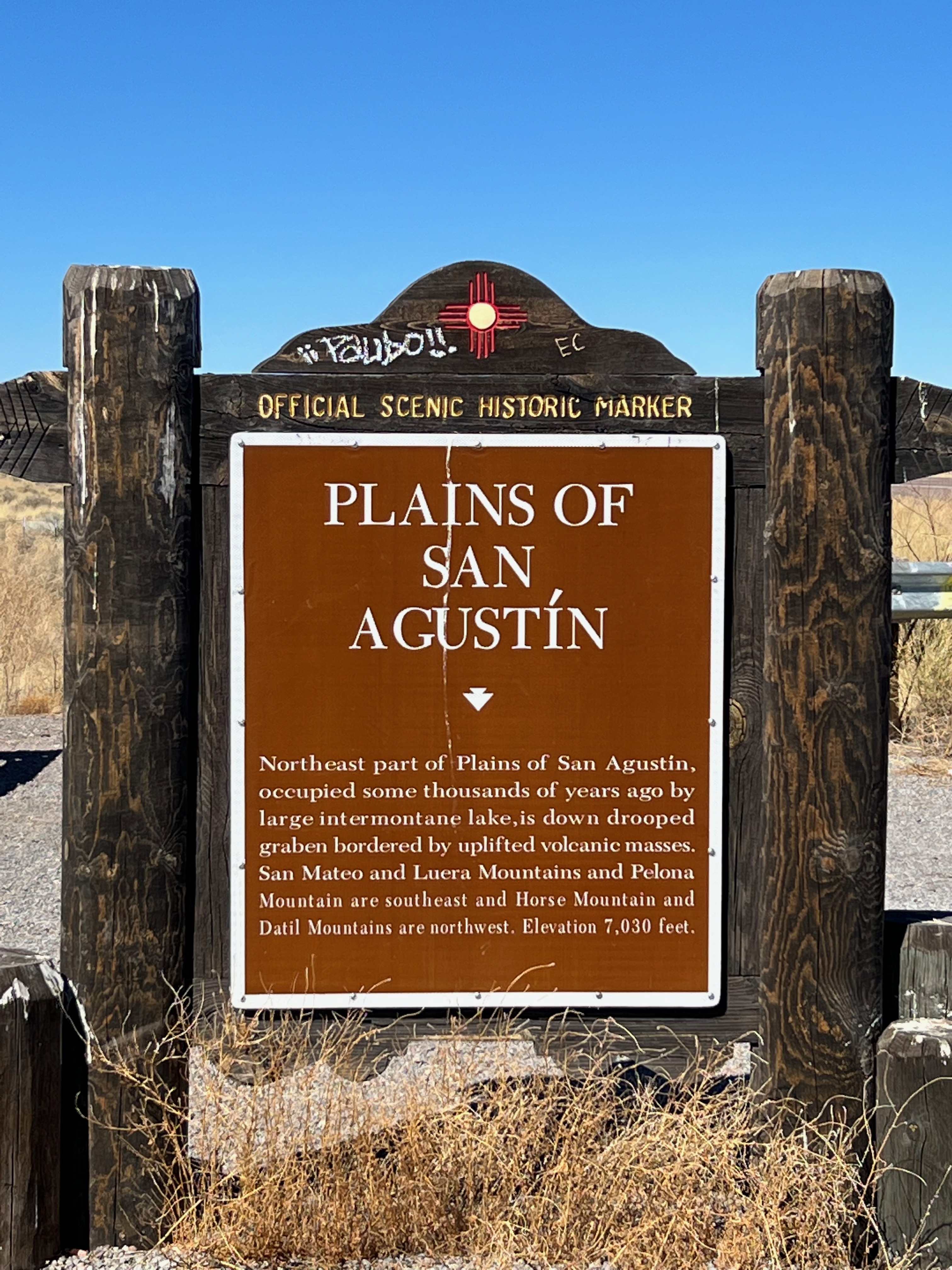
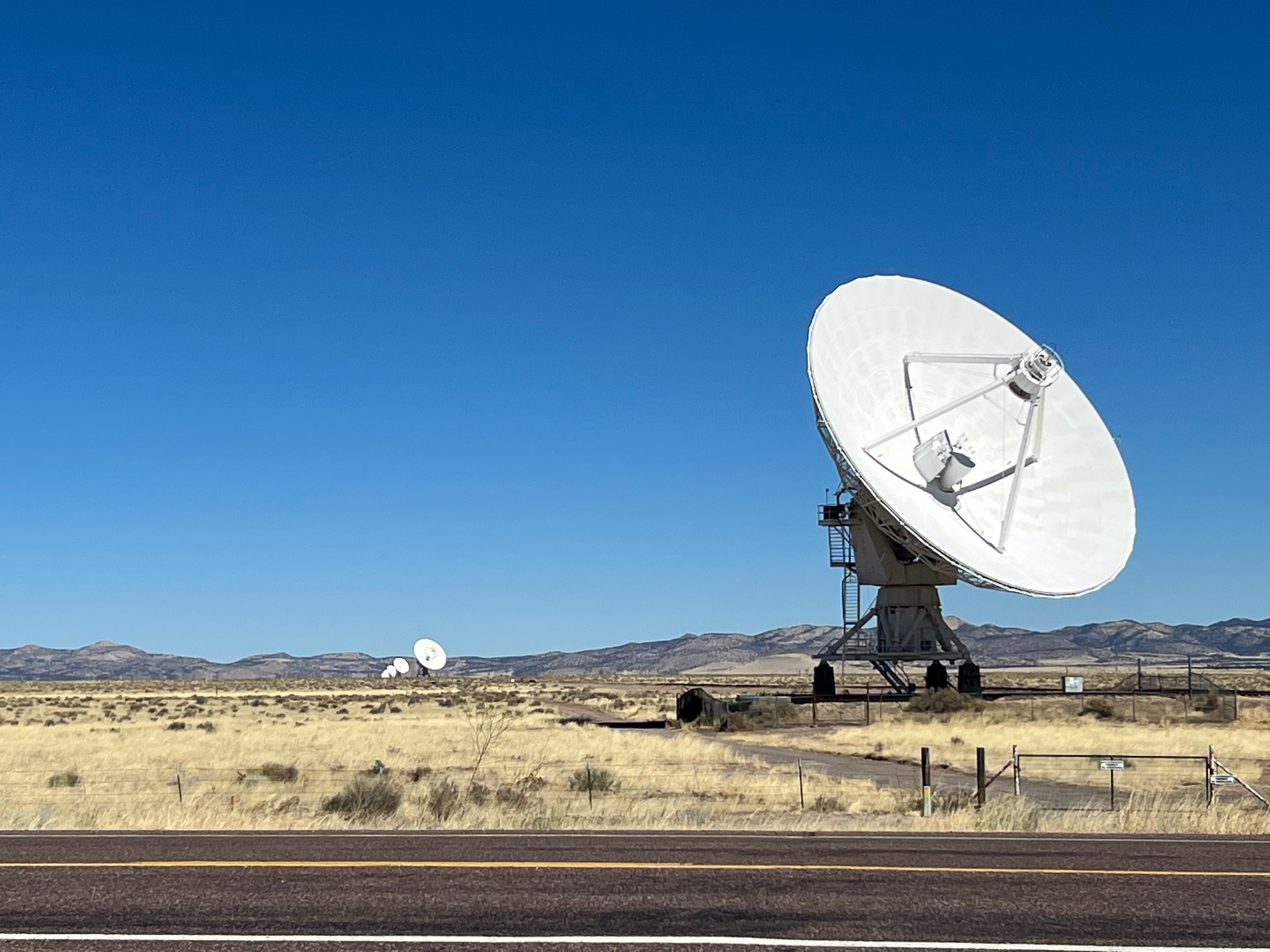
On those plains is a Very Large Array of satellite telescopes that comprise a Radio Astronomy Observatory. Sadly, the visitor center is closed, but there is the Augustin Plains turnout where I parked and took pics. I continued the climb until I hit Pie Town, home of the Continental Divide crossing. I bought my Airstream on Pi Day 2018 and I thought this to be a charming reminder of why I travel.
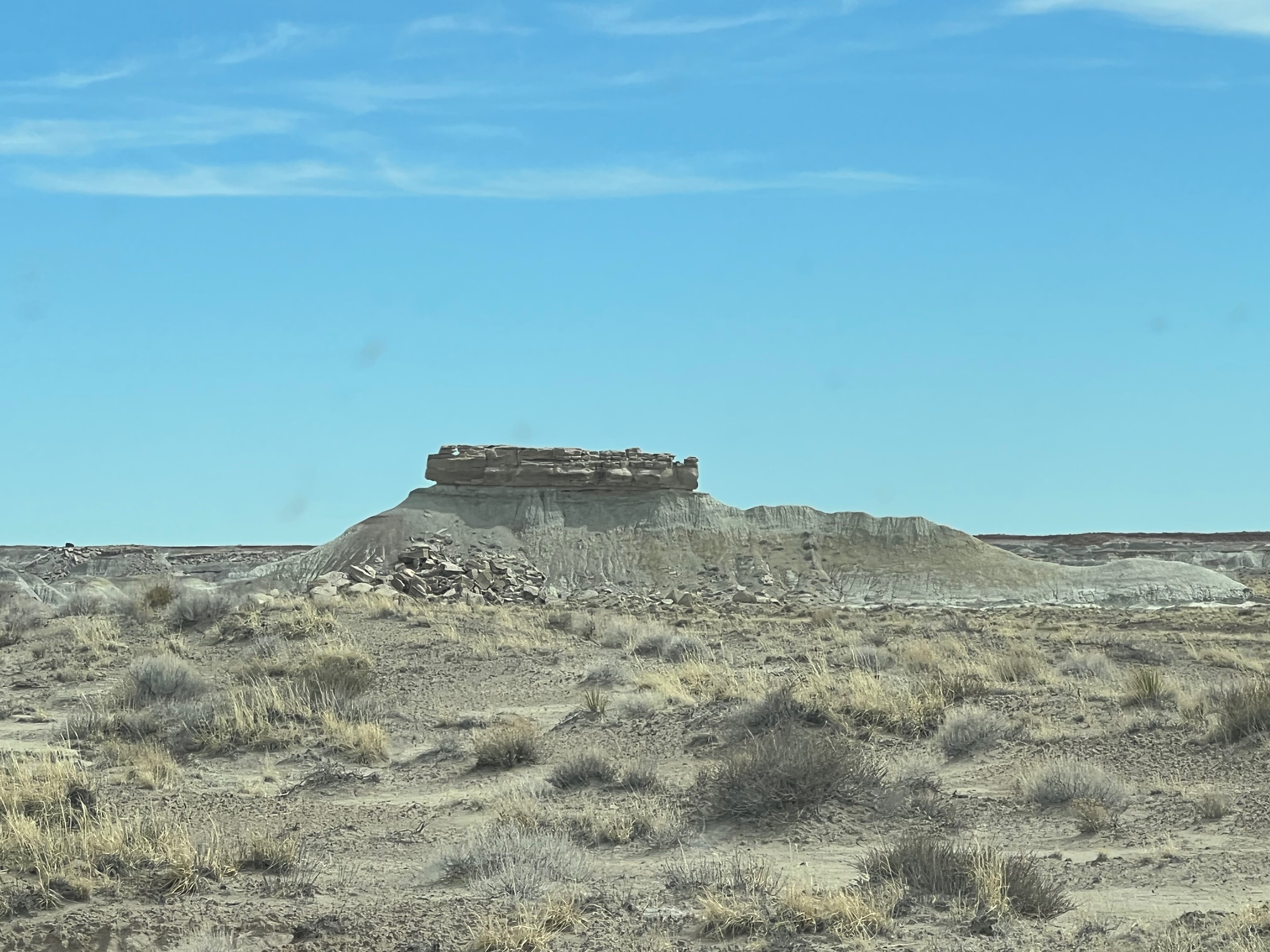
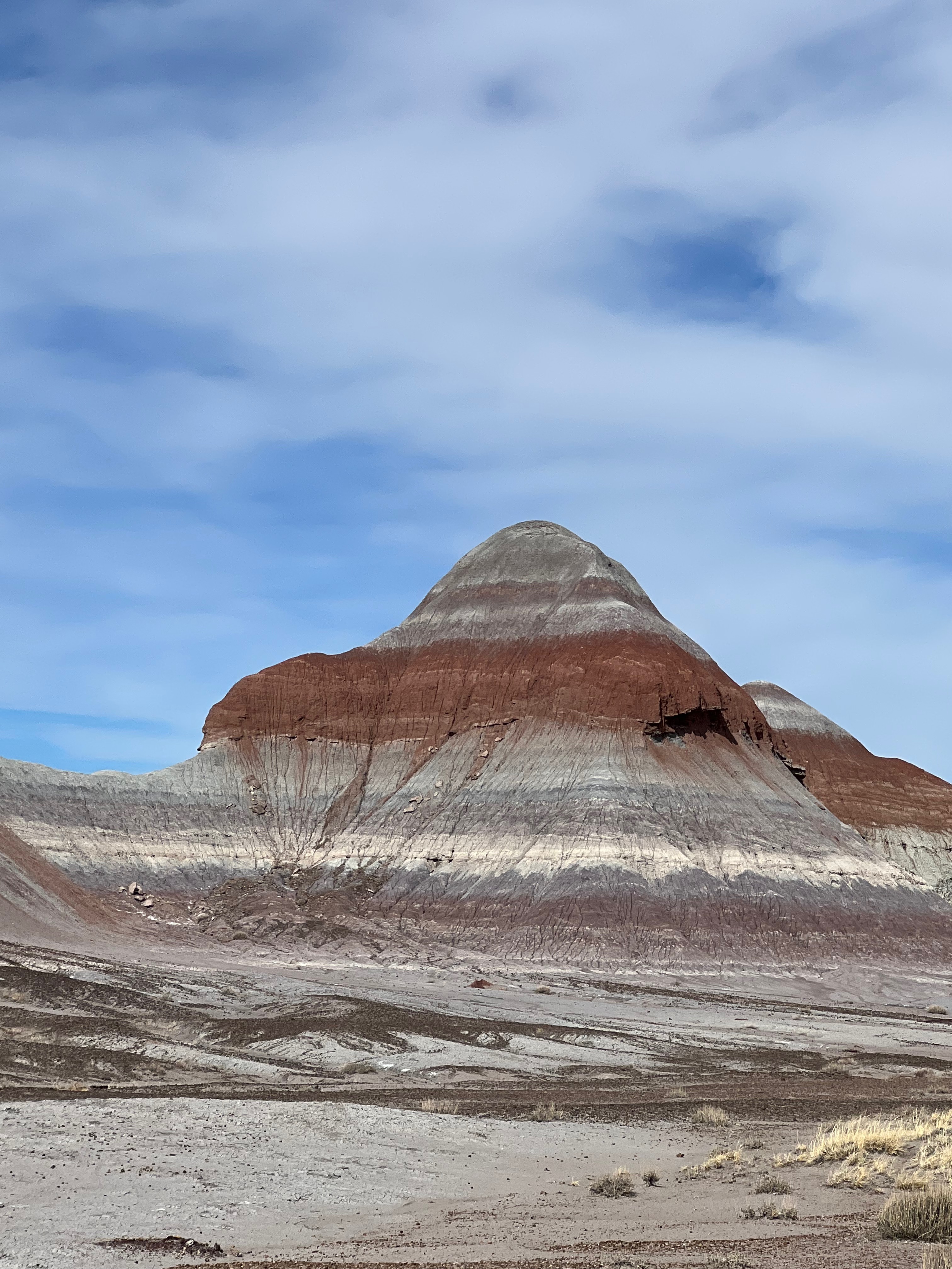
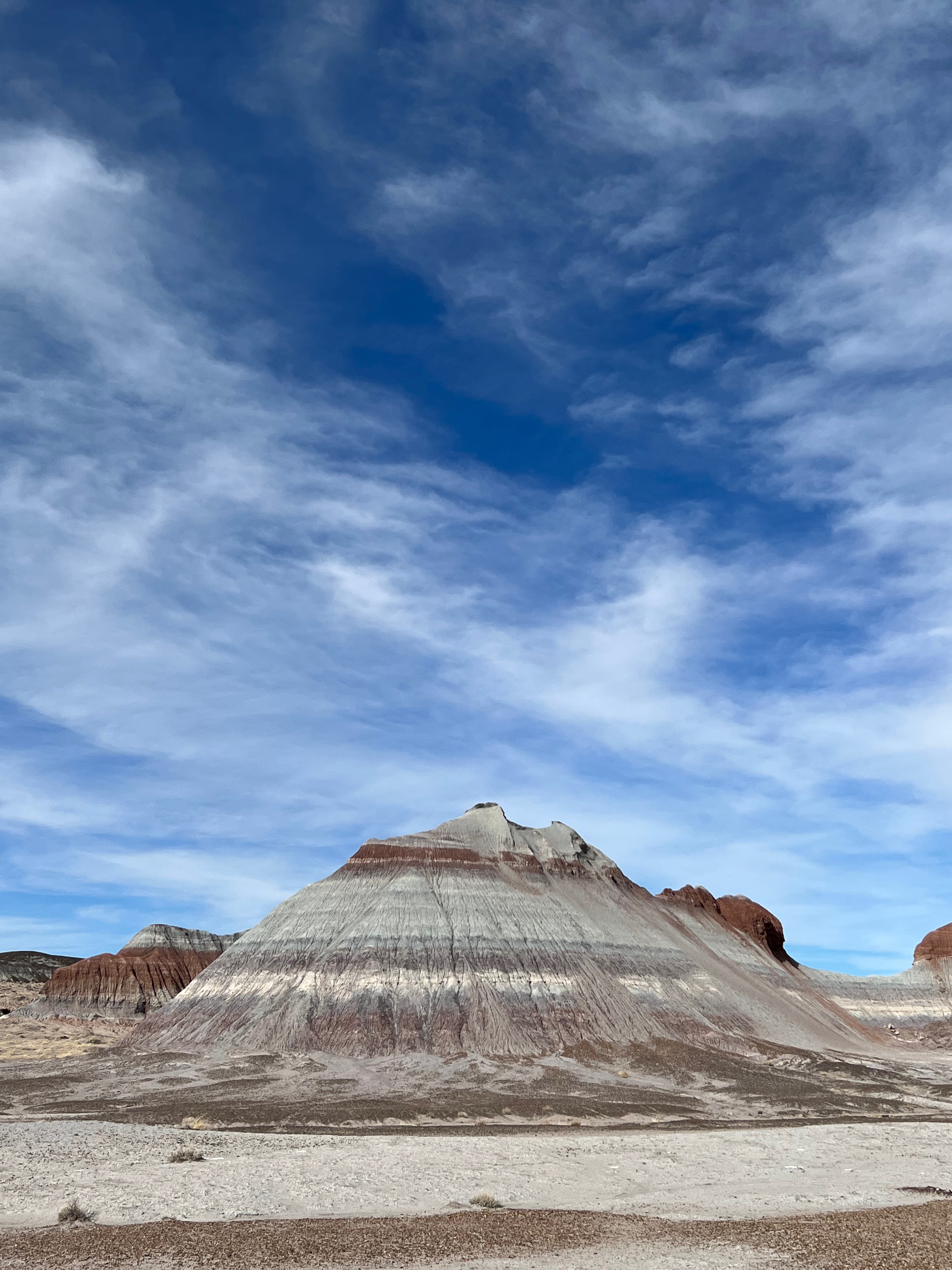
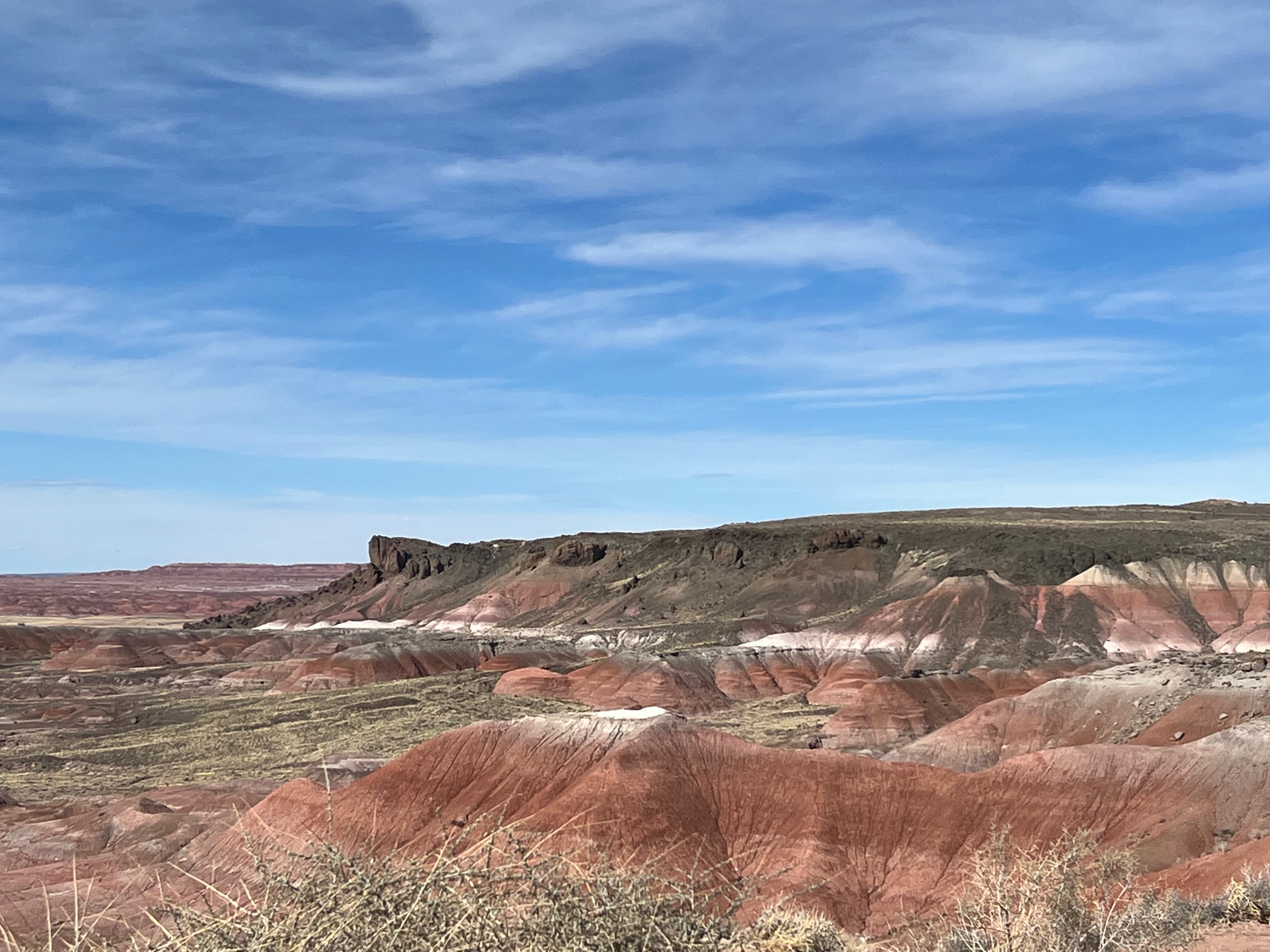
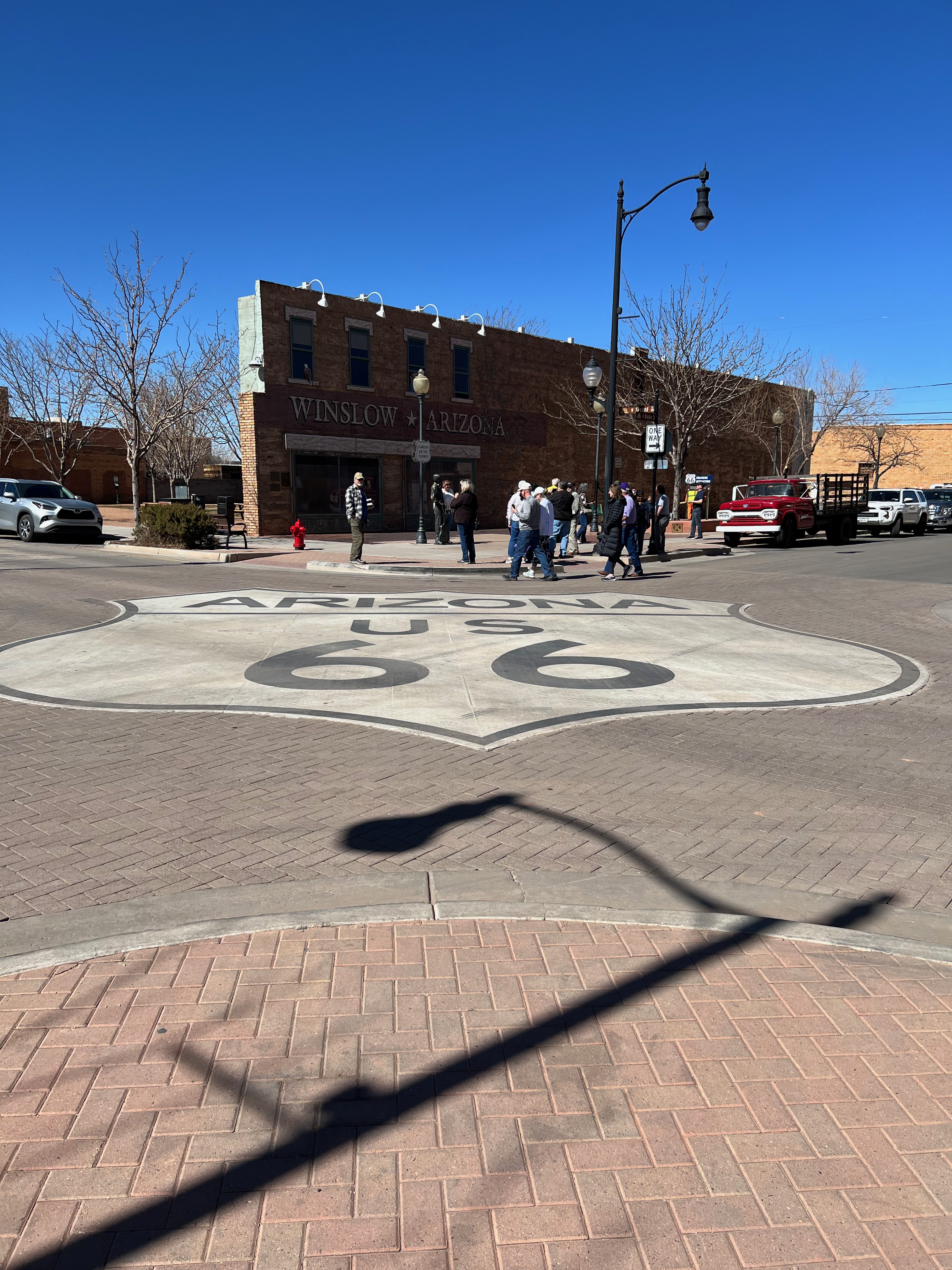
As luck would have it, near the end of my US Highway drive before catching I-40 is the southern entrance to the Petrified Forest National Park – which has now been turned from “want to go” to “visited” on my map. It has a 28-mile driving road that spans the park and I caught the Interstate at the northern entrance of the park in the Painted Desert along with the remains of old US Route 66 – the Mother Road. I love that my path keeps crisscrossing this amazing road that opened the country to California. The Park has lots of natural wonders and is quite distinctive. I couldn’t tarry too long because I wanted to make Winslow, AZ by nightfall.
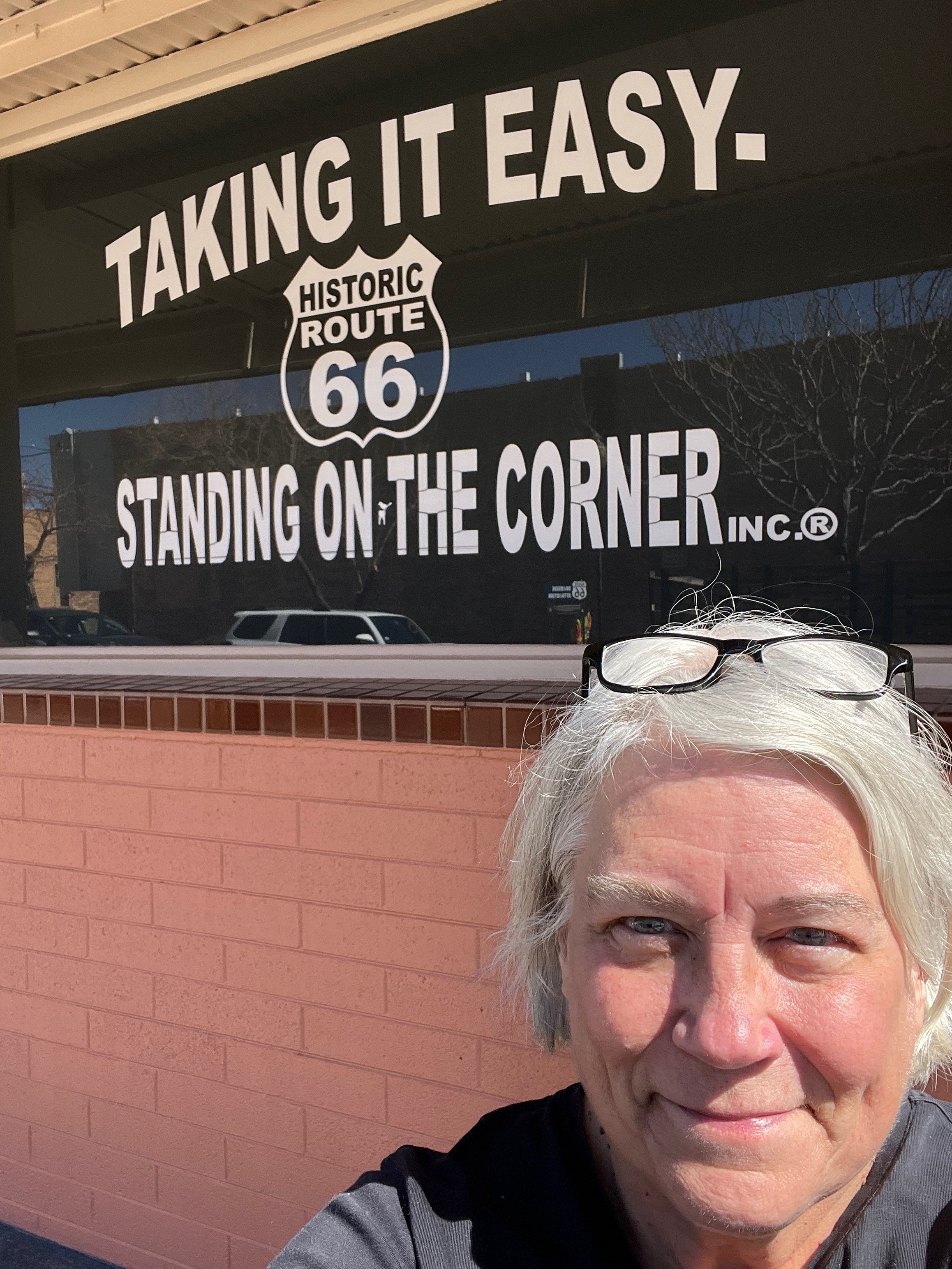
Winslow, AZ has special meaning for members of the Jones generation (I just learned this is the new designation for my birth generation). It is the actual site that the Eagles band made famous in their song, Take It Easy. This is my favorite band and this is my favorite song of theirs. Of course, this was a must-stop! Winslow is a dusty point on the Interstate. Without this attraction, I doubt anyone would make it a destination. But the celebration, complete with kitschy souvenirs, music playing, and statues of Don and Glen (bearing no likeness to the real people) stand on the famous corner. The US Route 66 logo coves the entire intersection. It was fun and memorable. I even snagged a cheap and nice city campground spot overlooking the Clear Creek Reservoir. Bonus: I met up with an RV friend there and had a nice time swapping stories.
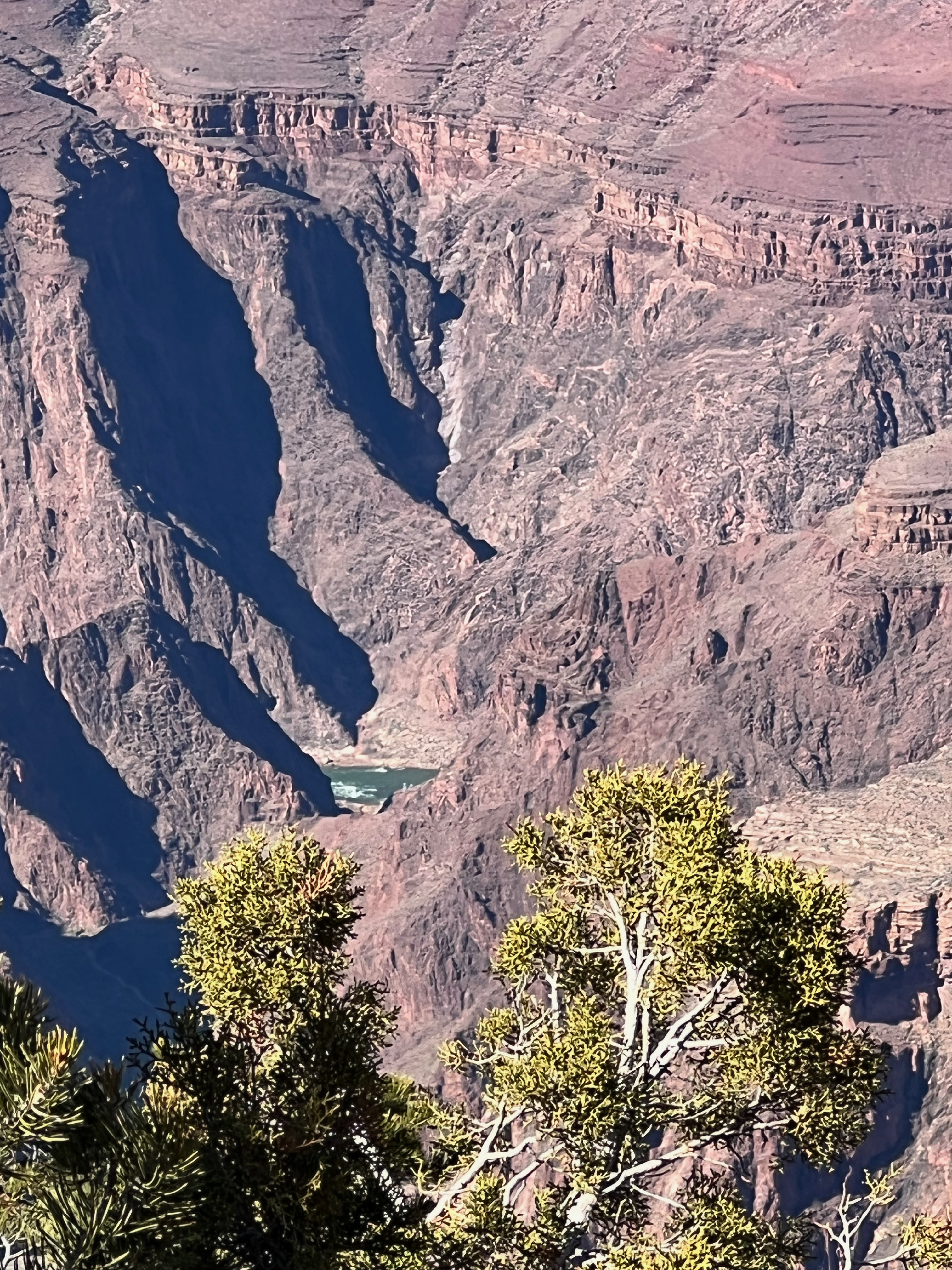
I hesitated but then decided it was worth the extra miles and ga$$ to make my next stop, Grand Canyon National Park. It was a bucket-list item, now fulfilled. The weather was beautiful and I found a nearby open campground. This time of year, many western government campgrounds are not open. Generally, the season starts in April. Finding camping sites has required a bit of sleuthing, but I scored with this place because it was only 30 miles from the park. The GCN Park campground is open but was fully booked. I’m so, so glad I went to the park. There aren’t any superlatives to adequately describe this place. It is wondrous in its scale and majesty.
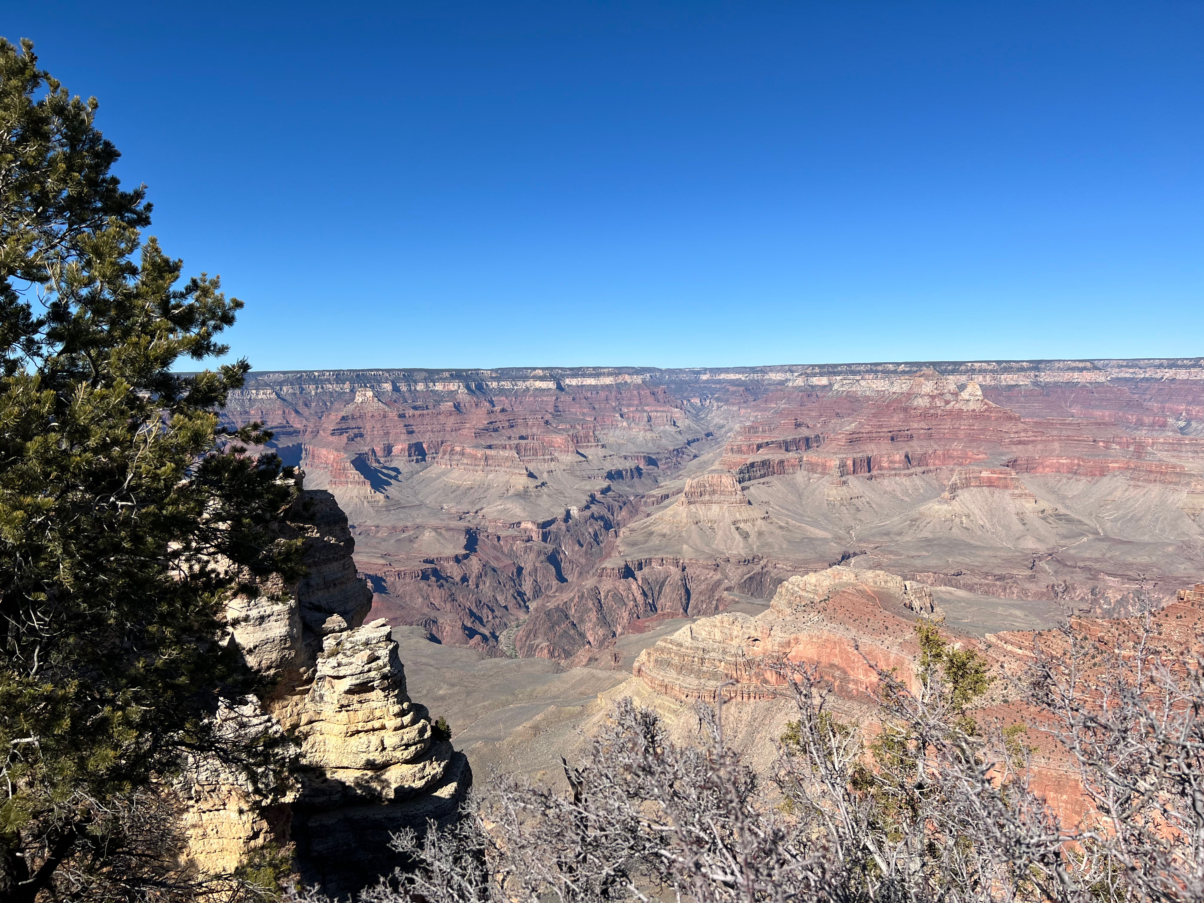
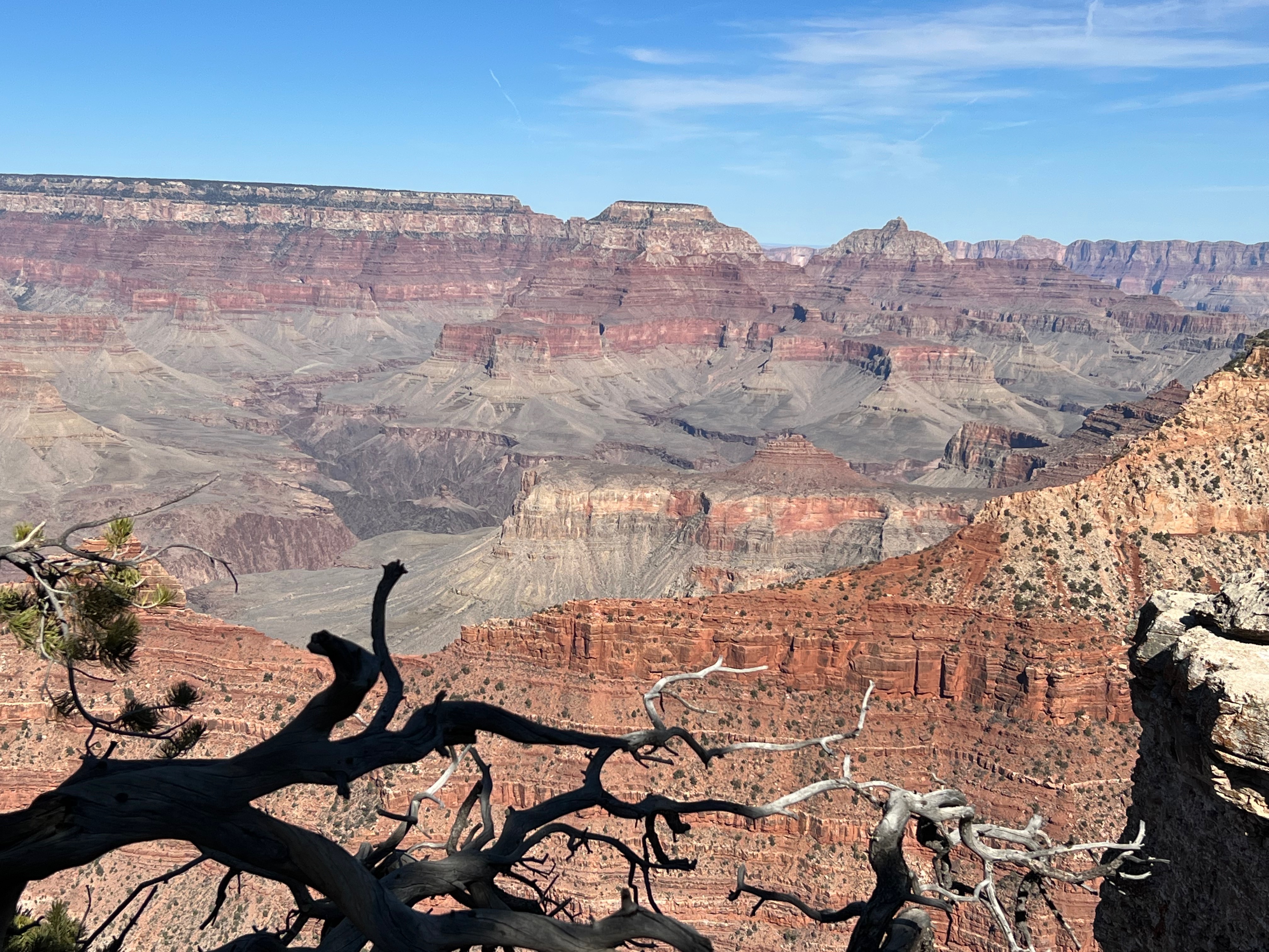
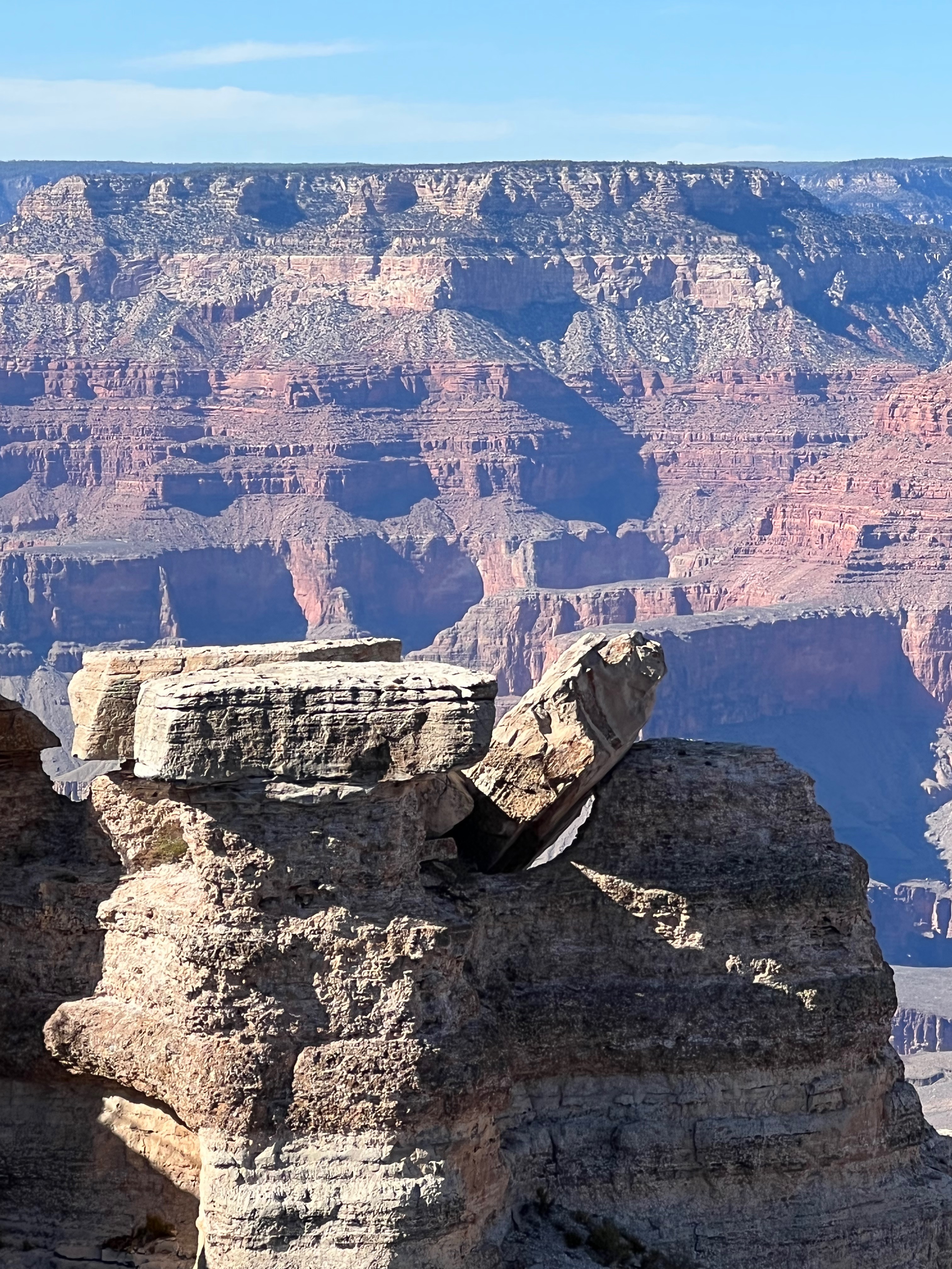
The colors, the formations, the depths, all captivated me and the hundreds of other tourists who walked the rim on the paved path. I only had the afternoon to visit and it took me an hour sitting in bumper-to-bumper traffic to get in. Spring Breakers came to visit too, I guess. Once inside it took another 30 minutes to find a parking space. Then I trekked to the rim. It opens up as you crest the hill and I gasped. As I got to the railing and saw it in full (as much as one can see from a single vantage point), I cried.
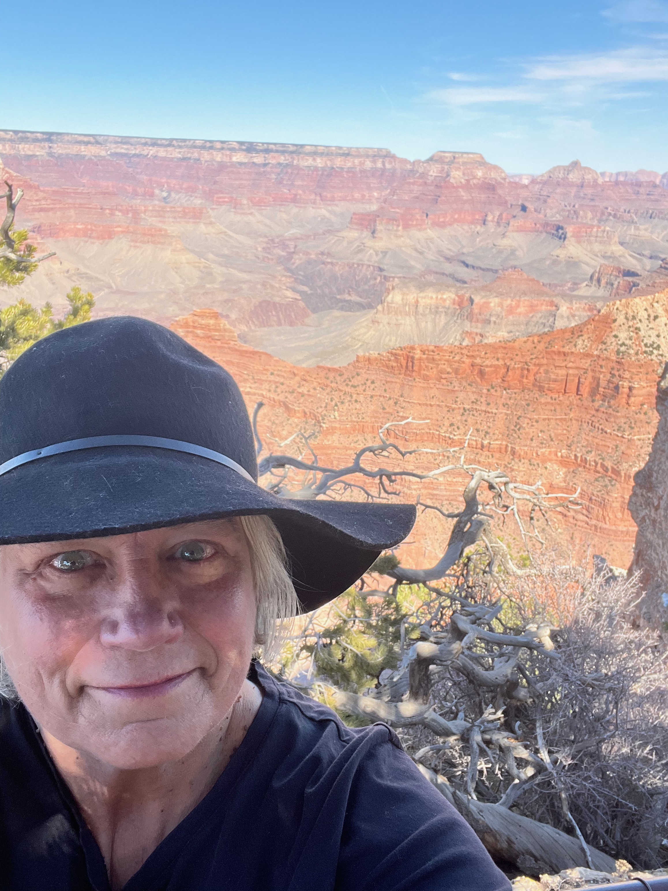
I have come to appreciate nature in new ways over these last few years. Most people stood at the rail, moved along, snapped some pics, and left – having had their Griswald family moment. I actually heard a little kid say, “well, we’ve seen the Grand Canyon, what’s next?” I stood at the rail and then walked along, stopping at each new vantage point to take it all in. I still have a bucket list item to camp on the North Rim, but it was not yet open for the season and it takes some time and effort to get there. Not possible on this trip. I was reluctant to leave the rim, but drove through the rest of the park, saw the mules, and headed back to the Airstream with vivid memories.
In the morning I took US 89 out of Flagstaff and off I went, up and then mostly down to Page, AZ. In the few miles before getting there I saw awesome scenery. There is the back of the Grand Canyon and then you corkscrew on some mountains with canyons off to the side with fantastic views. Page is home to Glen Canyon National Recreation Area. Glen Canyon Dam forms Lake Powell. In the Recreation area is Lee’s Ferry, a famous settler’s site as well as Rainbow Bridge National Monument (accessible only by boat). By this point in the trip, I was starting to get sensory overload. Every turn is a new beautiful sightline of mountains, new views of stratified, colorful rock formations of red, green, and even blue. I’m not afraid anymore to drive in these places. It’s not that I’m used to it, but rather, I have cast off my story of anxiety in favor of being the possibility of peacefulness in the face of the unknown. I have told myself the story of anxiety as if it is real and I have suffered all the typical symptoms. This trip I created a new possibility of being peaceful in each moment, even when I don’t know what’s coming or when facing a challenging situation. I do my research on roads right down to knowing where the steep grades are. I have a weather guy helping me plot out my trip so I don’t get stuck in bad weather. I know how to find gas, propane, dump stations, and campgrounds. I can be peaceful and I thoroughly enjoyed the trip to Page!
I was inattentive to photographs in Page. I camped at the Walmart with about 20 other campers. There was an expensive campground near the lake, but why? I bought some groceries and had a peaceful night. I did not join the hordes visiting Horseshoe Bend – the seminal U-shaped turn the Colorado River makes around an enormous rock formation on its way to the Grand Canyon. I saw it from a higher elevation on my descent into Page. Paying for parking and being in a throng did not excite me. Sadly, the bays around Lake Powell are nearly dry (much like the Lake Mead, NV area) as the west continues with a “record-breaking” drought. The Glen Canyon Dam hosts the historic Navajo Bridge. It is a beautiful feat of steel engineering and the separate pedestrian bridge is the 1929 original. You know me and bridges and heights. Best for me to keep focused on the car in front of me. It’s another story I tell myself and I’ll work on setting that one aside too.
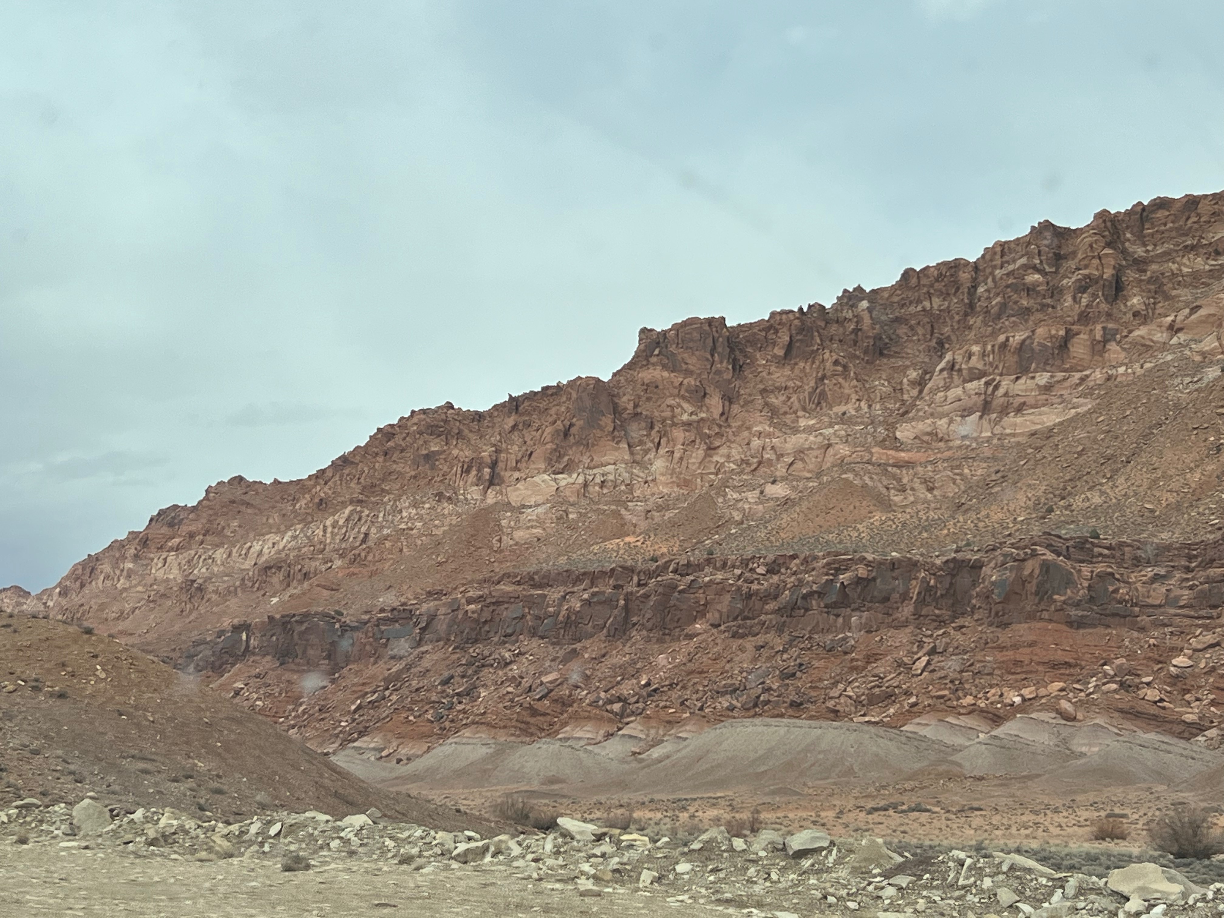
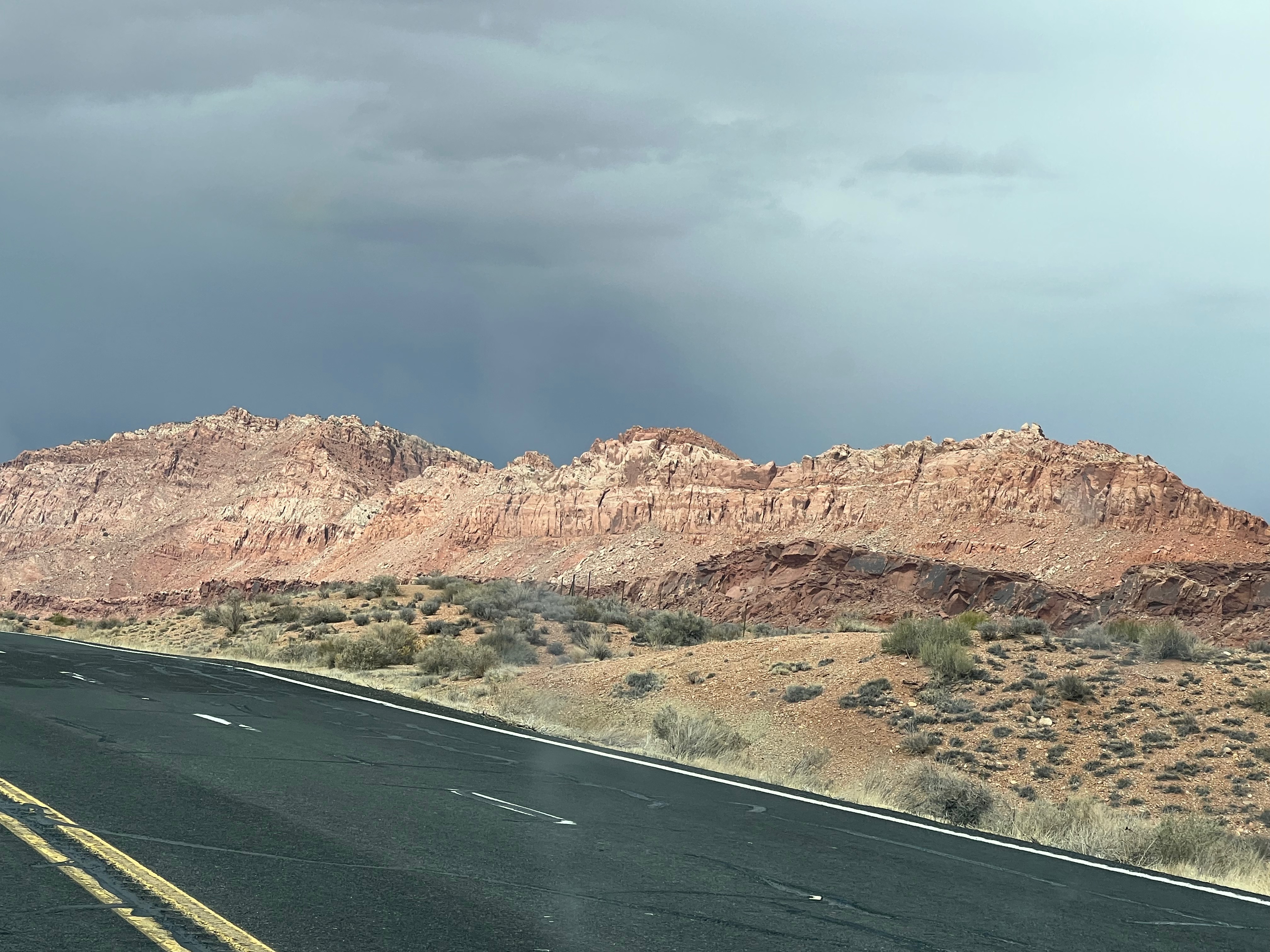
US 89 continues north through Utah. My next stop was Bryce Canyon National Park. Getting there is one of the prettiest drives you will ever take. The descent into the valley town of Kanab is breathtaking and the town is quite charming if you want to stop for shopping or a cafe. Next is Mount Carmel where you can turn off on Utah 9 and head to Zion National Park through the famous tunnel. I’ve been to Zion and decided to press north. There are a series of little towns, most with not even a gas station, but they showcase beautiful pasture land and scenic mountains all around.
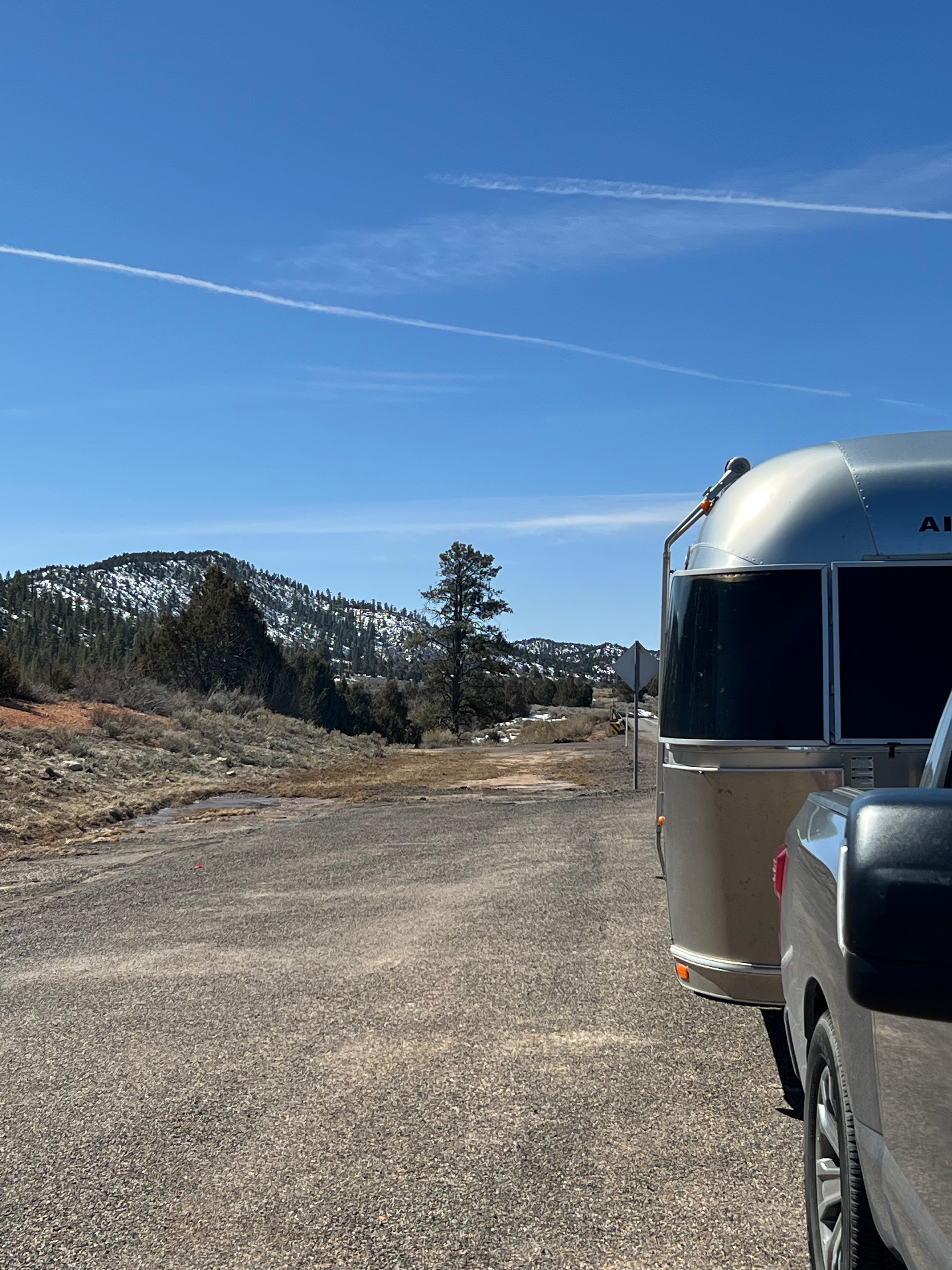
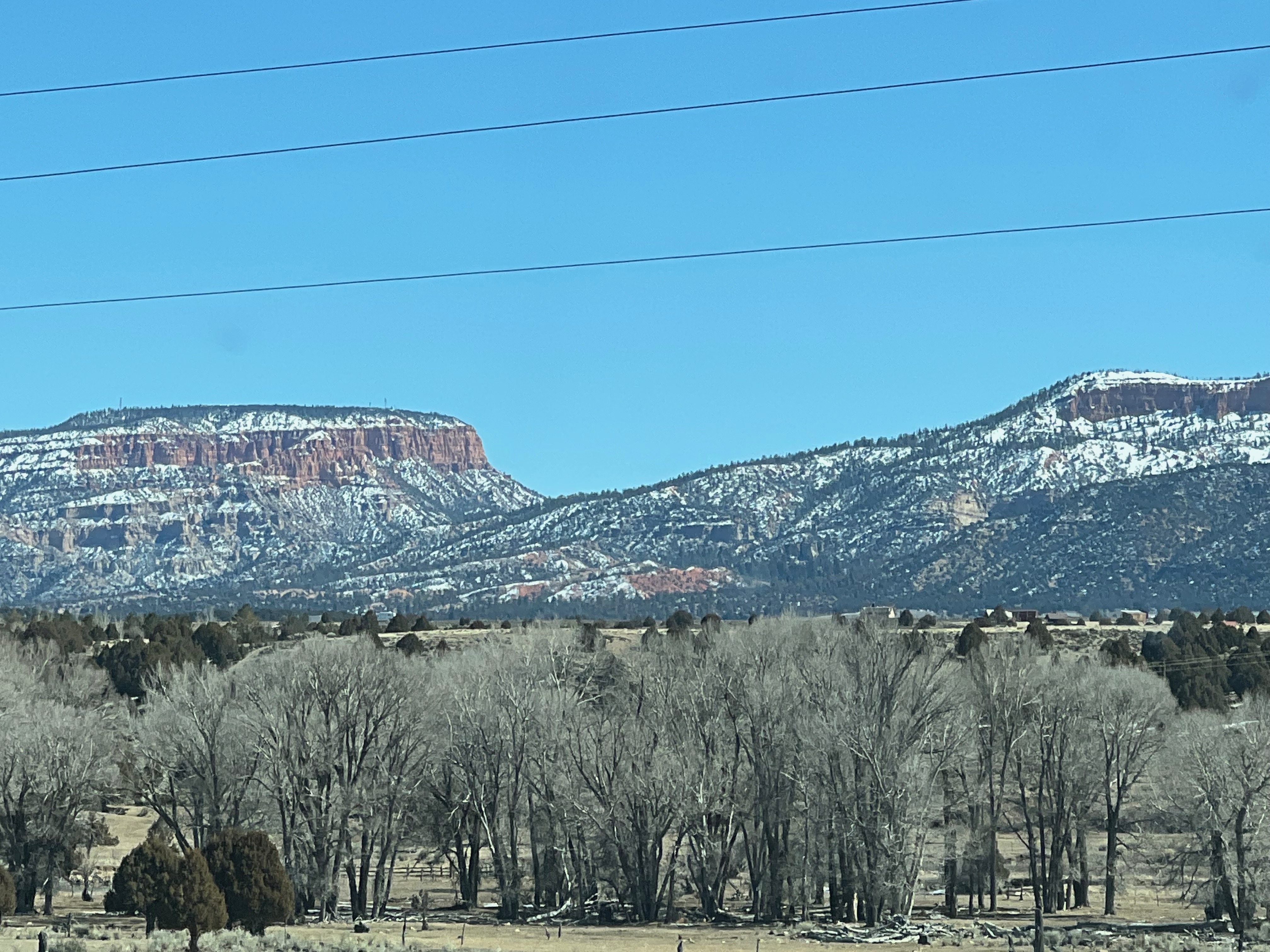
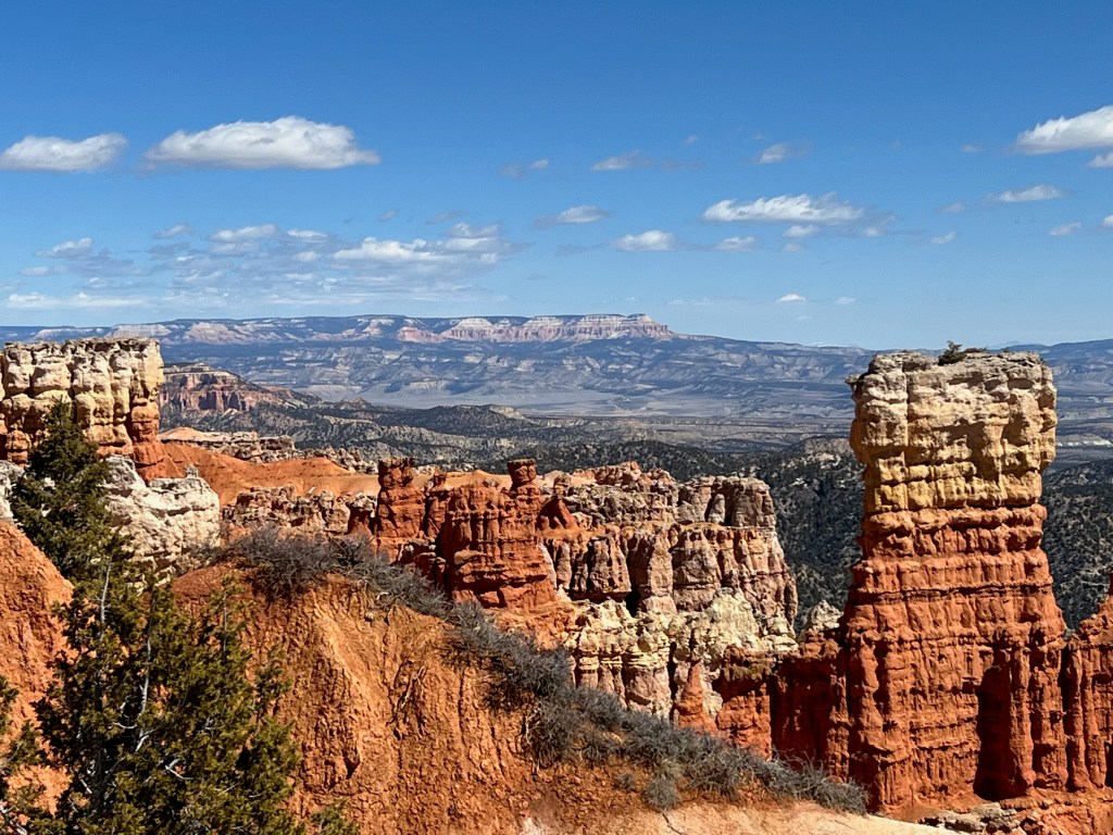
The Bryce area is red clay/rock country so most of the mountains are actually mesas and plateaus of red rock with the beautiful stratified rock colors showing. They look like ships on the sea. I had identified a good Bureau of Land Management spot at the crossroads of Scenic Byway Utah 12 and US 89 where I would turn to go to Bryce. I checked it out and quickly realized that my boondocking was not to be. Even though there was no snow on the ground (but plenty on the mountains), snow covered the ground recently. There had not been enough sun and heat to dry out the soil and the red dirt was far too soft to support the weight of the trailer over several nights. Plan B was a lovely, though expensive commercial campground in the nearby town of Panguitch where I spent a couple of very cold nights. I was at 6600 feet and though there was no precipitation, the nights do get c-o-l-d! Brrrrr. Luckily, my furnace kept me and my plumbing pipes warm and whole.
Bryce has been a fascination for me because of the rock formations called hoodoos. I think I enjoy saying that – hoodoo. These formations look like a potter has dribbled clay into statuesque spires. I guarantee you haven’t seen anything quite like this unless you’ve been to southern Utah.
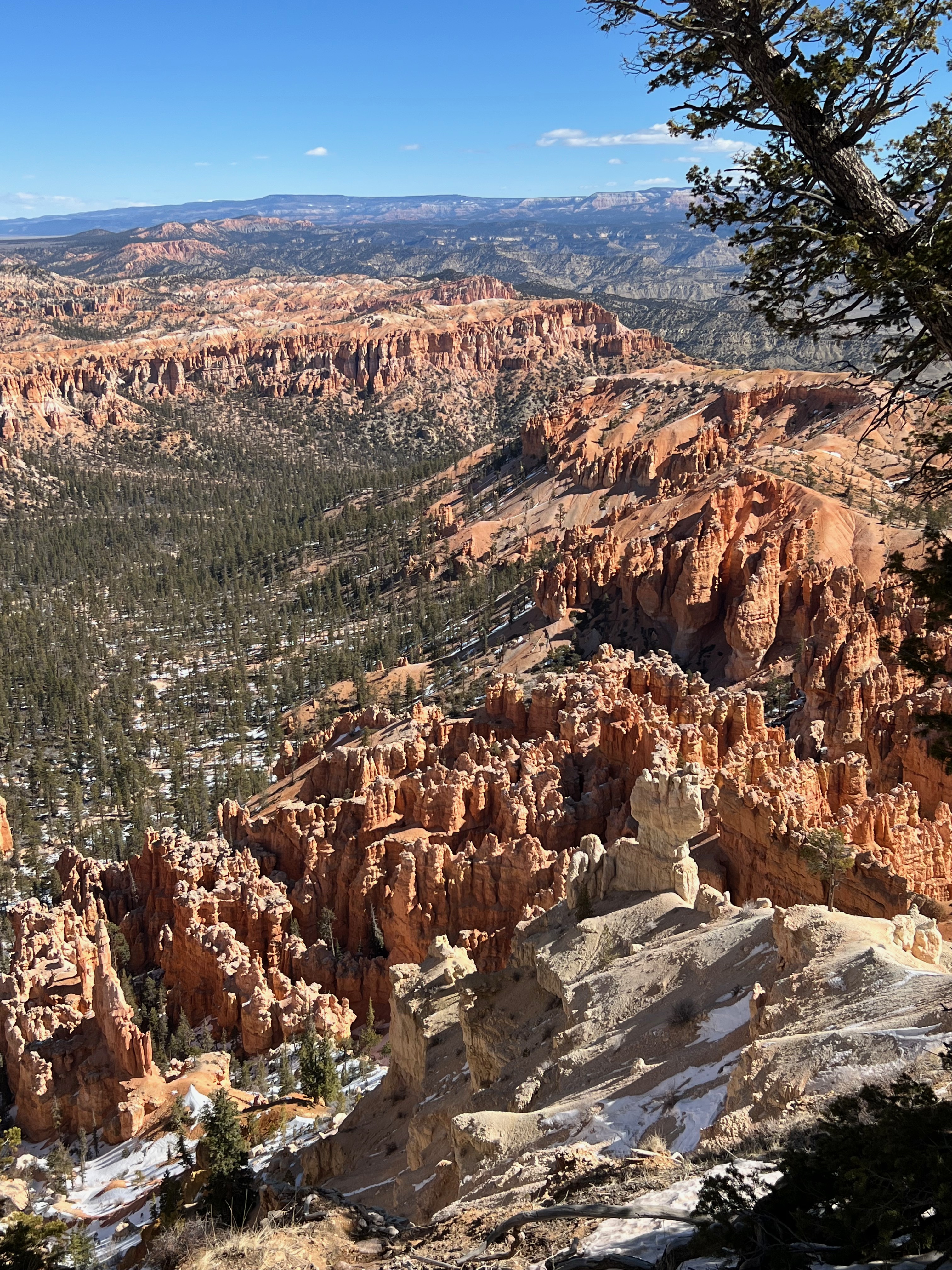
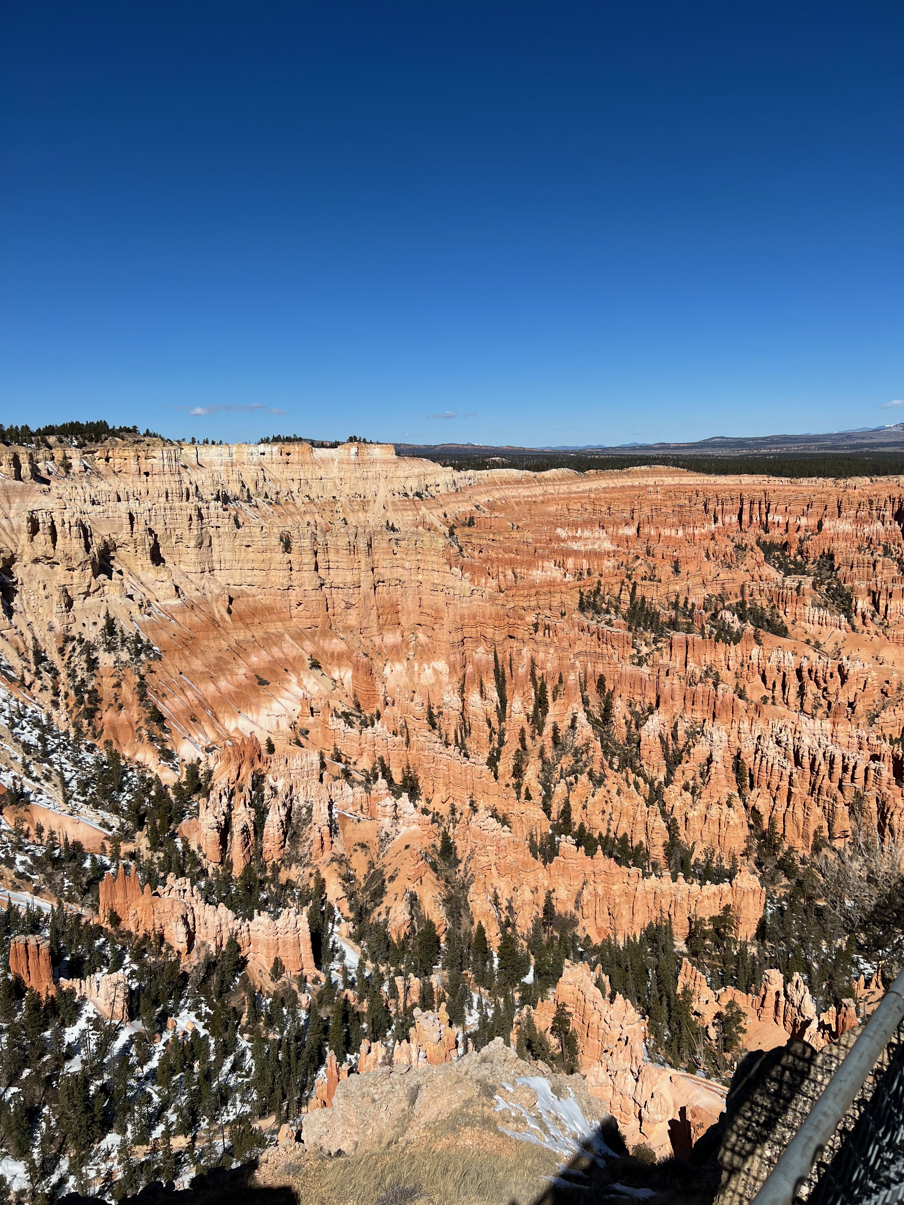
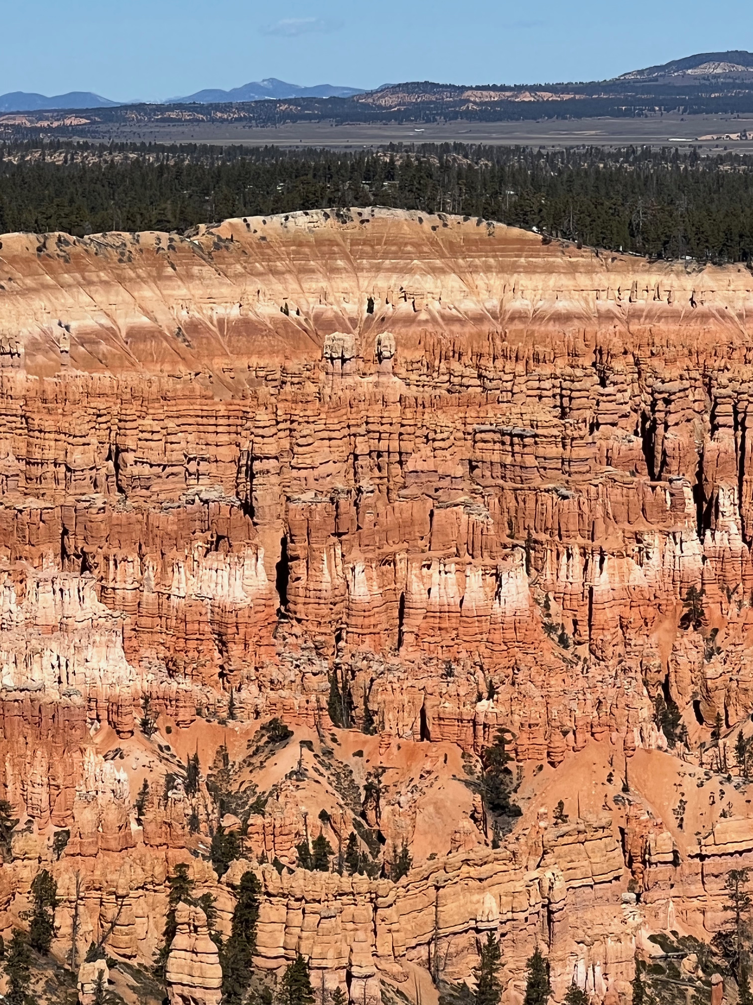
Because it is a canyon, you start at the rim. If you are an intrepid hiker, you can trail to the bottom and then, back up. Not for me, but the park has an 18-mile driving tour of the rim with lots of pullouts where you can park and look into the various side canyons. The reward is at the end or rather the 9100 foot top of the park at Rainbow Point. Here you can see the full throat of the canyons, the valley below, and vermillion colored mesas in the distance. It was a jam-packed painting. I stopped at more canyons on the way back down to the lower level of the park. Each one was more breathtaking than the last one.

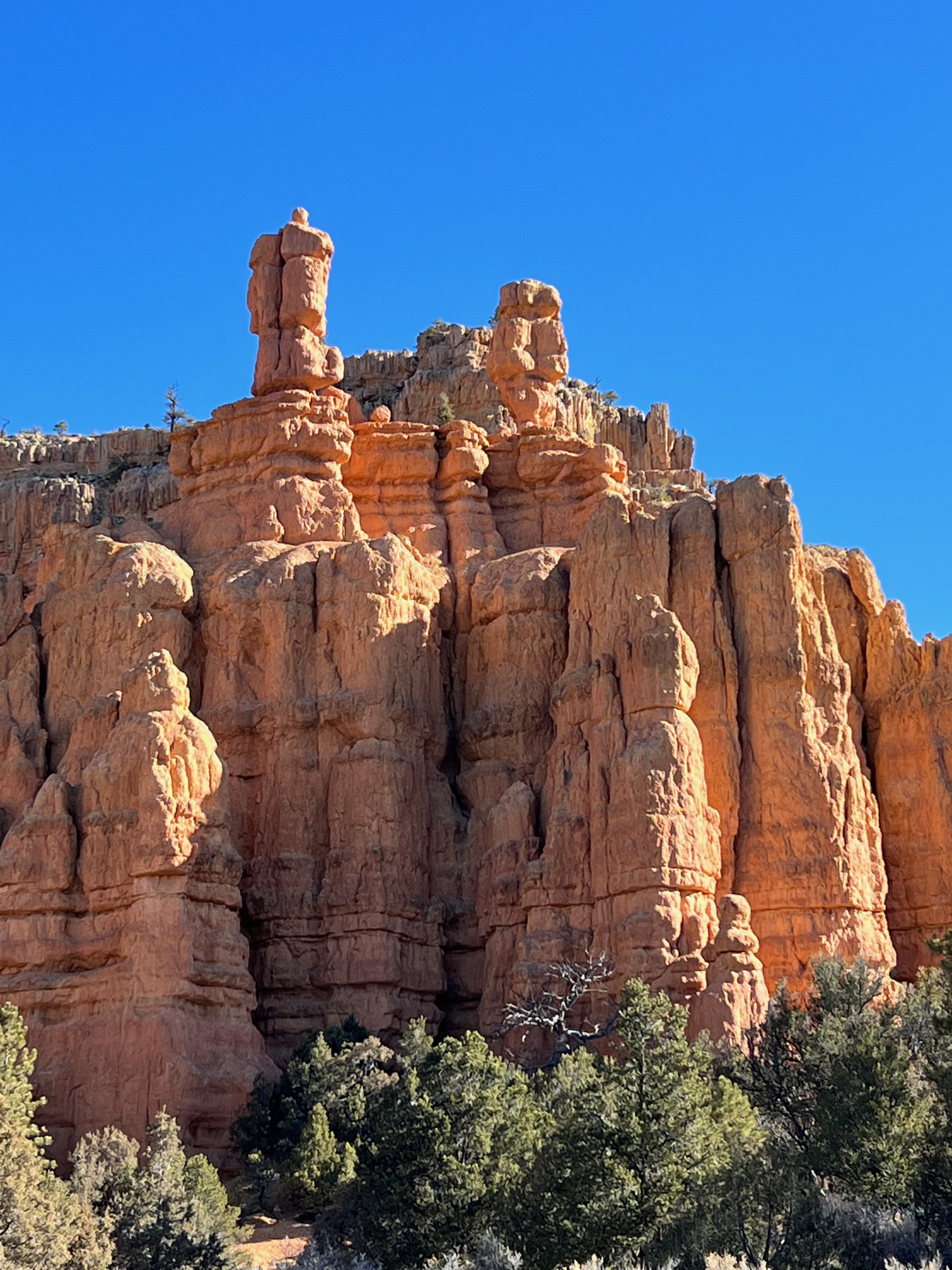
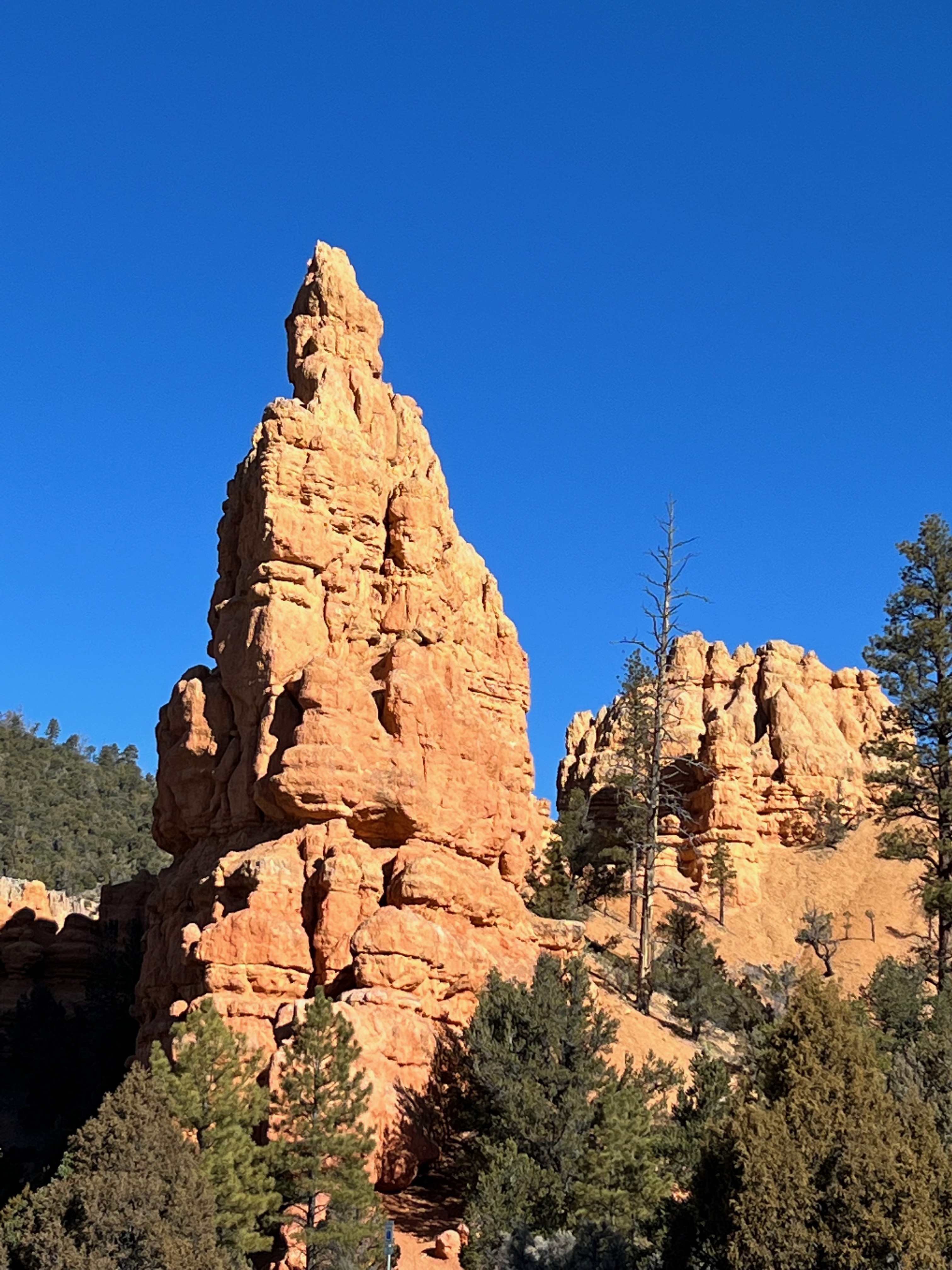
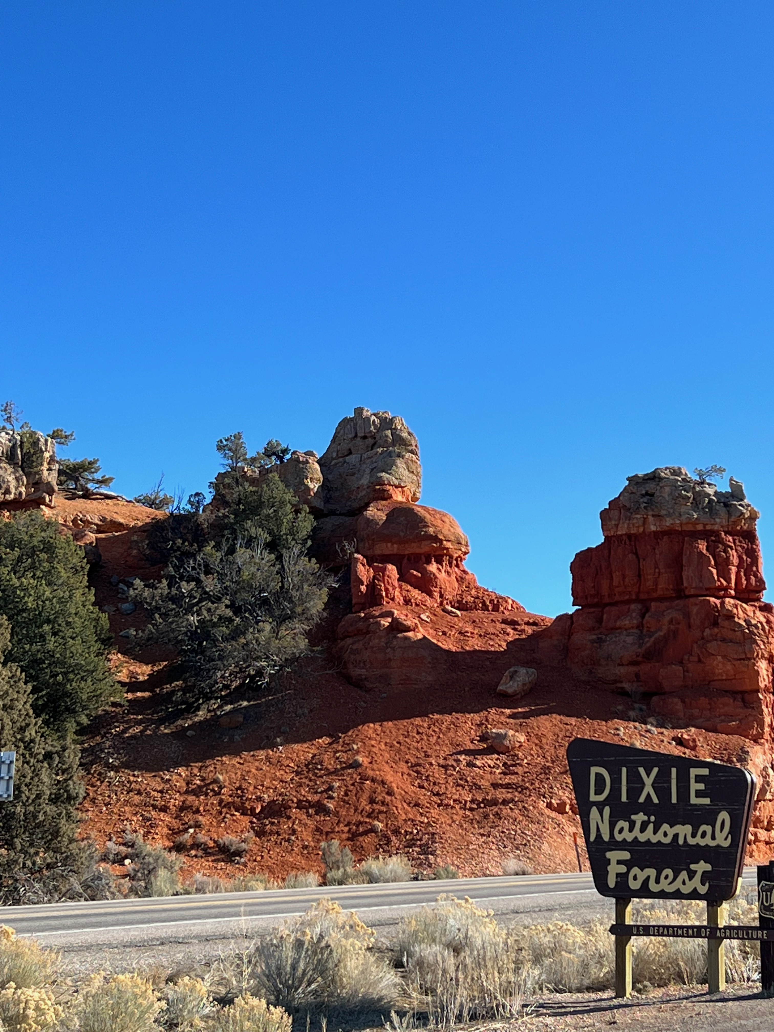
It’s 17 miles from the US 89 turnoff to Bryce entrance, but don’t worry, there’s plenty to enjoy. The Dixie National Forest covers much of the area. Within that is Red Canyon – filled with bike and walking trails. Sadly, neither Bryce nor the Red Canyon campgrounds were open yet. Snow and ice on the ground make camping tricky. The scenery is wonderful and there are two fun tunnels to drive through. Woot!
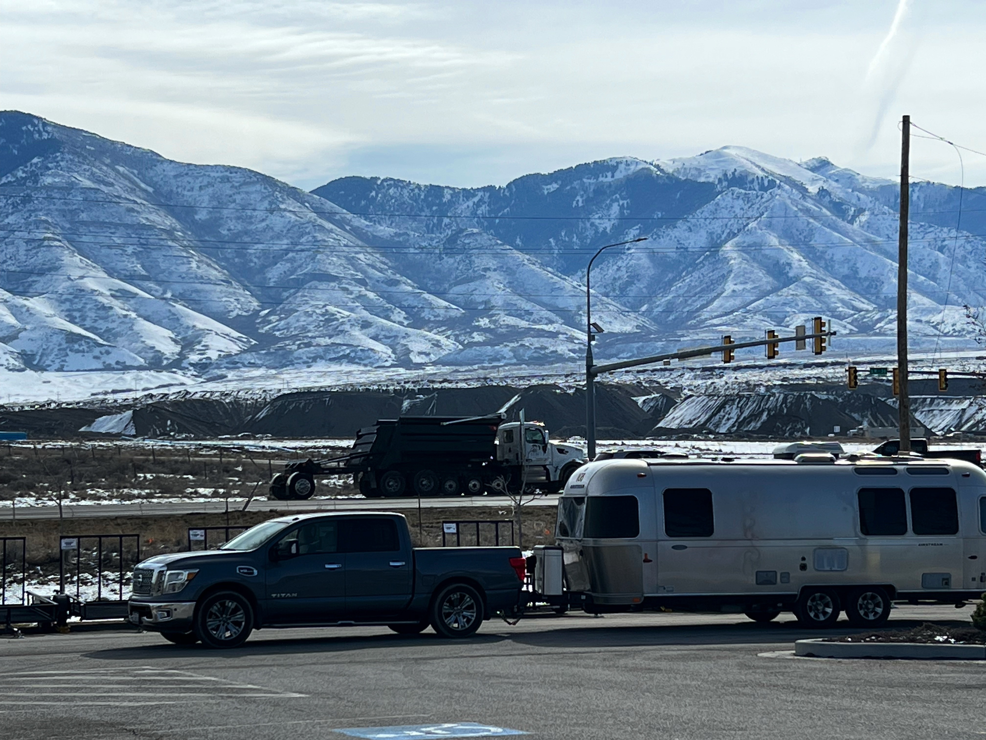
I completed my US highways road trip when I got to Sevier, UT. The drive from Panguitch to there is marvelous. You literally wind your way in between foothills to the nearby mountains. Along the way is a stop at Butch Cassidy’s boyhood home – a log cabin and pasture area. A bypass driving loop can be taken around the property. Nearby is Circleville, a town with a western-themed ambiance to commemorate its native son. I picked up I-70 at Sevier and rode downhill to I-15 with more downhill driving into Salt Lake City. The terrain changes to Alpine-sized mountains with lots of snow still resting at the peaks. I’m enjoying a snow event here as I park in a friend’s driveway just west of SLC. I’m waiting out the weather before I head to Idaho.
Like those that have gone before me, and I’m thinking of William Least Heat-Moon, I like taking the less-traveled and scenic routes. My trailer precludes me from going too far off the well-trod path, but getting off the Interstates provides a bounty of inspiration.
For anyone who is interested in writing about their own adventures, here is a cool opportunity!!
Recreation.gov Announces 2022 “Share Your Story” Writing Contest for Outdoor Adventurists
The second annual contest seeks stories that touched hearts, inspired laughter, and created memorable experiences in the great outdoors for the chance to win high-valued prizes
Denver, CO (January 11, 2022) — Recreation.gov launched the second annual “Share Your Story” adventure writing contest, inviting visitors of America’s federal public lands to submit stories detailing their experiences exploring and spending time in the great outdoors. Experiences must have taken place between January 1, 2020 and April 30, 2022. Visitors can submit stories from now until April 30, 2022 for a chance to win great prizes and have their story featured on Recreation.gov. The 2021 inaugural contest generated nearly 1,200 entries.
Find all the cool prizes and rules here – https://www.recreation.gov/shareyourstory

Leave a comment