The Northwest portion of Washington state is a gem. Much of the state is beautiful, but this area is especially compelling. The over 500 mile Cascade Loop is billed as Washington’s Ultimate Road Trip. I did about 65 miles of it the other day from the Skagit Valley, to Deception Pass on Fidalgo Island, and down through Whidbey Island where I got on a ferry to cross back to the mainland. This portion was spectacular and I look forward to driving the rest of the loop crisscrossing the northern Cascade mountain range. Why aren’t I doing it now? Snow. The northern road, Route 20 is not yet open, making it impossible to get to the Northern Cascades National Park. The southern road is Route 2 and is open-ish across Stevens Pass. On the day I was touring the road was closed for avalanche prevention work – which includes some blasting to move snow down the mountains in a controlled way rather than have a runaway disaster. Welcome to Northern Washington!
I started in Mount Vernon, WA because it is home to the annual Skagit Valley tulip festival. April is the highlight month. I may have toured a little early because some the fields were not yet full. I did see some lovely blooms and colors and the backdrop of the Cascades can’t be beat. Know that if you want to walk in the fields you must purchase a tour ticket for $15. You get a parking spot (which is not available anywhere else in the valley) and you can wander the fields. The other fields are strictly off-limits. Who wants a bunch of tourists trampling the flowers? There are precious few side roads with no traffic that have enough of a shoulder to briefly pull off to take a picture.

I believe the mountain in the background is the perpetually snow-covered Mt. Baker. This was a beautiful view. One of the fantastic things about this spot is that if you look in the opposite direction, you will see the Olympic Mountain range on the Peninsula. It’s stunning. More on those mountains in a bit.
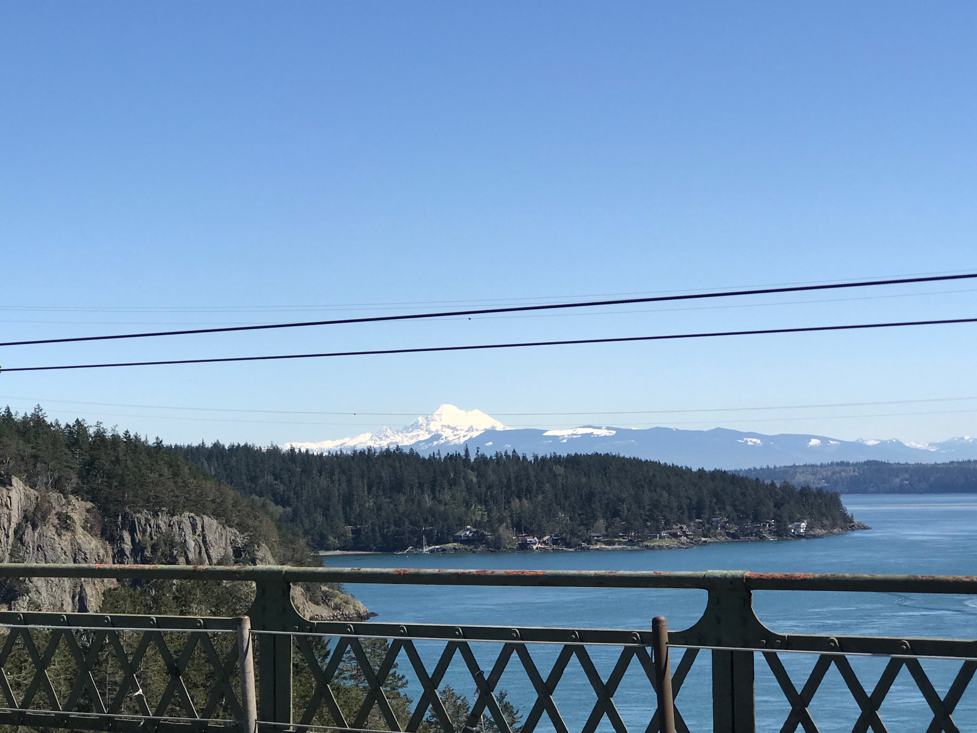
The next leg of the drive is going northwest to Fidalgo Island and then through Deception Pass to Whidbey Island. The Deception Pass State Park is a mixture of old growth forest and rugged coastline. I visited there on a cloudy, foggy day in the fall. This time was full sunshine. There’s a beautiful old bridge that crosses the waterway pass that connects Skagit Bay to the Pacific – or Salish Sea, that runs between Victoria, Canada and the OP, USA. The bridge and the park were built by the Civilian Conservation Corps in the 1930s. The bridge is immediately recognizable with its arches and concrete flourishes. I parked and walked onto the bridge where a metal railing rises above the concrete and some metal poles and rails keep the cars away from you. The bridge bounces a bit as cars and trucks rumbly by. I hate heights, so it was a testament to my determination that I got these pics.


Whidbey Island is a typical “island life” type of place. There are several small towns with resort style living as well as the regular folks who work in the stores. Second homes are popular there for Seattleites and plenty of people commute to the city daily. There is a Naval Air Station on the island made famous in the movie, “An Officer And A Gentleman.”
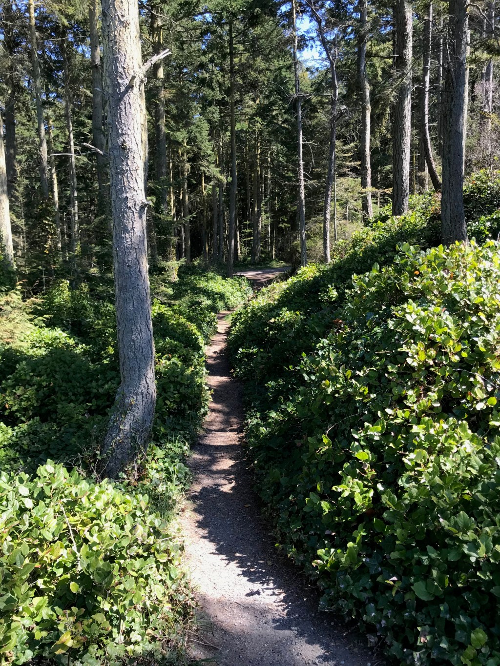
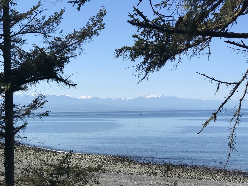
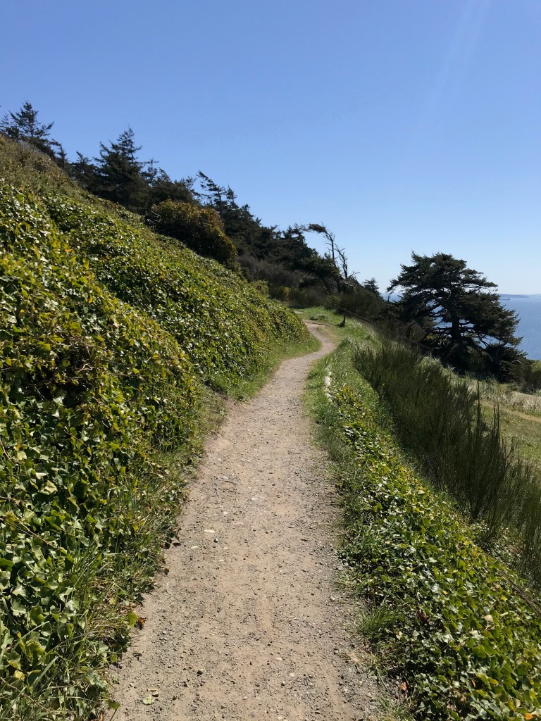
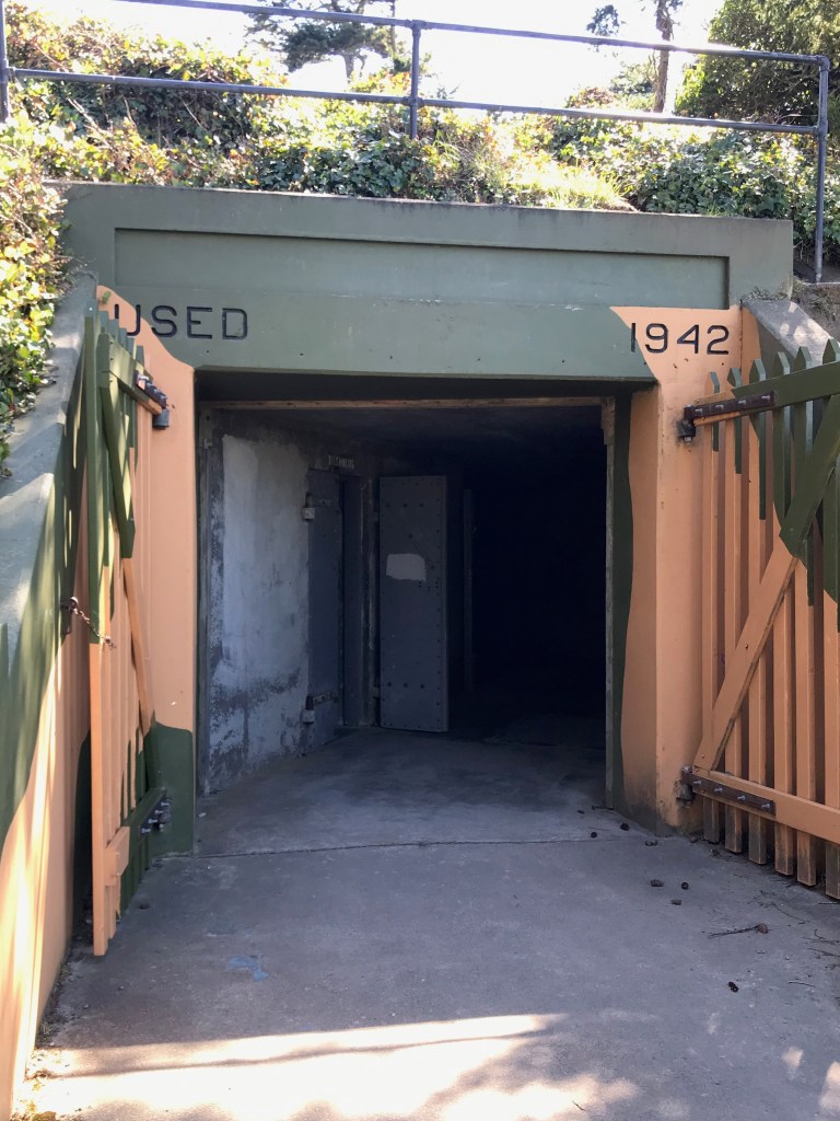
I found a fantastic state park that is perfect for day tripping. Fort Ebey State Park used to be a gunnery location in case foreign adversaries tried to sneak in with submarines or other ships into Puget Sound. It sits on the westernmost tip of the island and overlooks Admiralty Inlet. The views are incomparable. You can picnic at the beach and enjoy going down to the water or sit on the bluff next to the old gunnery stand. On the bluff you get an uninterrupted view of the Olympic Mountains. The glaciers are visible and this time of year there is still plenty of snow on the mountains. Then, there are the Kettle trails. Miles and miles of trails in this vast park to hike the forests. It was a delightful find.


At the southern tip of the island in Clinton, I rode the car ferry over to Mukilteo on the mainland, just southwest of Everett, WA. I got a senior fare for $8.80 and it’s only about a 20 minute ride. Some people got out of their cars to go up top. I stayed below and watched the scenery. It’s quite disconcerting to look forward and see you’re moving, but realize the vehicle you’re sitting in is stationary. Got an excellent view of the side of Mt. Baker. You can see it’s volcanic remnants.

I’m looking forward to real spring when I can go up into the Cascades and see some more of its beauty. Meanwhile, I got another shot of Rainier on the way home. It never gets old.


Leave a comment